


The Rexford-Slesse Horseshoe: The Trip of a Lifetime

Updated: Apr 27
From August 19-24, 2025, my friend Ben and I set out for a 5-day traverse over 25 peaks. We completed it, but only after 3+ years of scouting, planning, trying, failing, more scouting, and re-planning. Read-on and watch-on below! This blog posts dives more in-depth than the Film, so keep scrolling if you are interested in the details.
Buckle-up, this is a long one. I justify the length of this post because it took 3 years to accomplish this linkup, which itself took 5 full days.
Table of Contents
Short Summary of "Forging the Horseshoe"

Shortly after climbing Slesse for the first time in August of 2022, Ben and I returned to the Nesakwatch Creek Valley in September, climbing the Nesakwatch Enchainment, and again a week later to climb Labour Day Buttress. Atop Labour Day, Ben and I began to consider the possibility of linking up all 25 summits in "The Horseshoe." In 2023, Brennan and I did the Slesse to Pierce Traverse, scouting the last quarter of the ridgeline, which Ben and our friend Nich had done in 2021. Ben, Nich, and I planned on a full attempt in 2024, but Ben and Nich had to bail due to injury. My friend Mike and I ended up trying the full Horseshoe in early July 2024, but bailed on Rexford after slow progress due to snow on route. Much was learned, most notably that every section would need to be scouted before trying again if we wanted to better our odds at success. In September of 2024, Ben's ankle was recovered, so we embarked on the bottom 50% of the U-shaped-route. Perfect weather gave us time to complete a 1.5-day blitz mission of the Silesia Traverse. This trip was very confidence inspiring, prompting Ben and myself to set our sights on 2025 for re-attempting the full Horseshoe.
Slesse '22 Nesakwatch Enchainment '22 Labour Day Buttress '22 Rexford Ridgeline Traverse '24 Silesia Traverse '24

Prepping for the 2025 Trip
In January of 2025, Ben got an opportunity to back-pack guide in New Mexico from May until early August, so we decided to attempt the route in mid-August. Only 5/25 peaks remained un-scouted by us, so in late July, I recruited Mike to explore the Slesse Massif, undoubtedly the hardest and most daunting section of the entire Horseshoe. Mike and I had a wild experience, but successfully made the second known traverse of the full massif. With virtually no stone unturned (only Pocket Peak untouched), we now knew every water source, route line, camp option, and drop-bag location.
The only thing holding me back was whether the trip was worth the risk involved of 5 days of rugged ridgeline travel. An avalanche in Spring of 2024 claimed the lives of three mountain friends, prompting us to re-evaluate our risk tolerance. My feelings of mortality disrupted my courage for 2024's Rexford Traverse, causing Mike to lead most of the pitches. Even though I felt really solid during the Slesse Massif, I didn't want to make a mistake due to losing my mental edge during the full Horseshoe. Further, I didn't want to let accumulated fatigue result in a miss-step in the consequential terrain. After talking to Ben over the phone, we knew that we at least had to try, and could always bail if we didn't feel confident to continue.
Hiking in the Drop Bags
With all cylinders firing (physical, mental, emotional), I bought food and filled up three drop-bags to hike up to different locations on the route. Jas and I spent an afternoon filling up three bags with all the supplies. Since Ben wasn't quite home, I recruited Sam, Nils, Nate, and David to help haul the drop bags to Rexford, Labour Day, and Slesse. August 8-10 was a fun weekend of peak-bagging and enjoying the backyard with friends, but I was quite tired after over 60km, 5,000m, and 30+ hours of hiking. Drop Bag 1 at Rexford had 6L of water along with the largest cache of food for 2 full days. Drop Bag 2 at Labour Day had no water (with the plan being to fill up our reservoirs to 8L each at Pocket Glacier) and 1 day of food to travel as light as possible through the Slesse Massif. Drop Bag 3 at Slesse would have 8L of water and 1 day of food to make it out to Pierce on the final day.
Drop Bags ready to be filled! Water to be filtered en route Sam and Greg on N. Nesakwatch above Drop Bag 1 Greg, David, and Nate at Drop Bag 2 Greg, Nils, and Sam on Slesse, above Drop Bag 3

Waiting for Weather
Finally, Ben returned to Chilliwack from his road-trip with Abbi back from New Mexico. I was relieved to see rain in the forecast to delay our departure so that I could recover from the drop bag excursions. Finally, after resting and waiting for the rain to clear, Ben and I spotted a weather window. Our time off from work was a little tight, as we had to get back to work by Monday the 25th, so we last-minute decided to get a head start by leaving on Tuesday evening, August 19th.
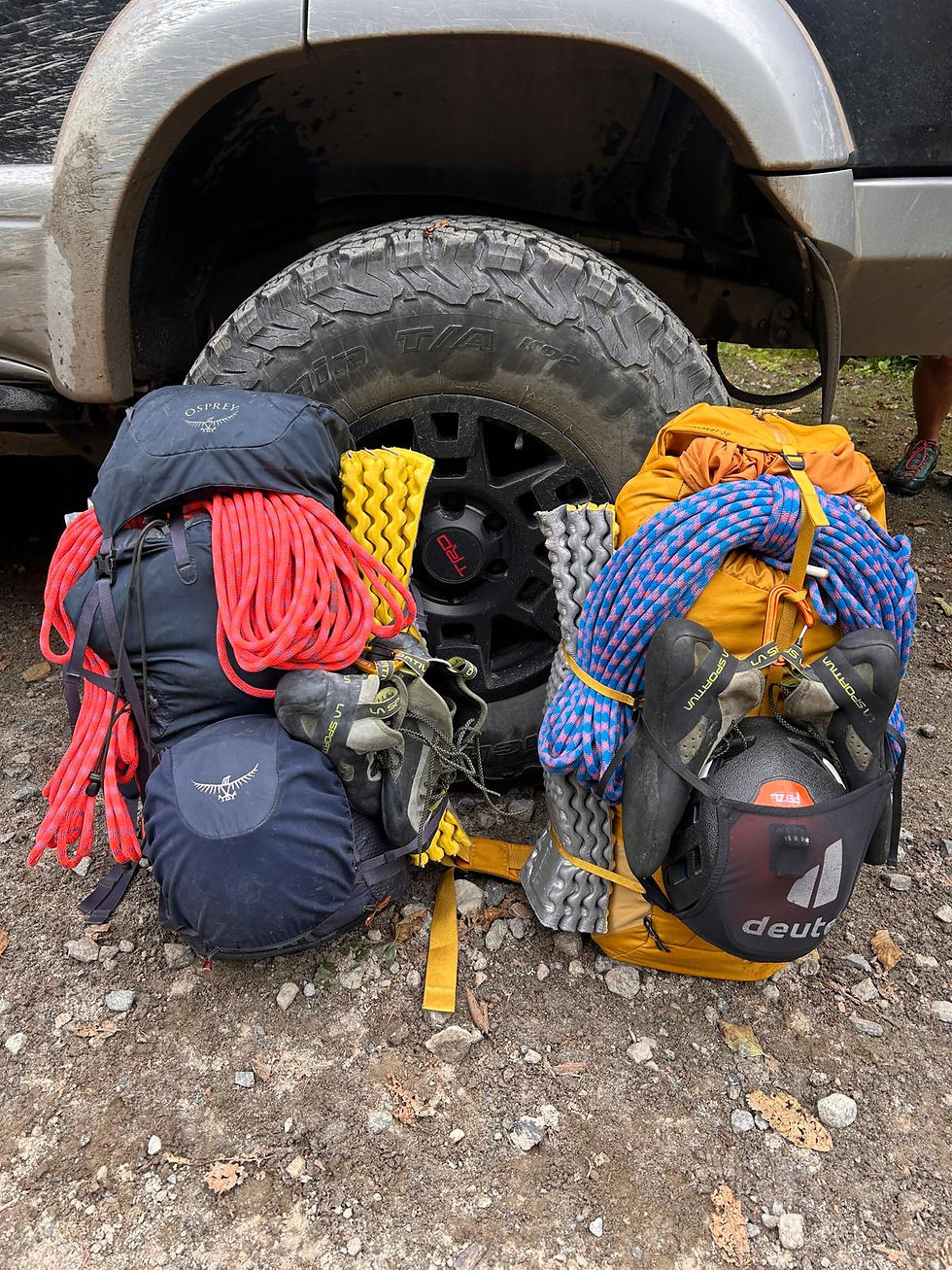
Packing List
Unlike some of my other trips, I lacked the fore-sight to lay out all of the gear in a pretty picture for the blog. I was a little too pre-occupied with filming footage for the Film and forgot to get photos of everything! The biggest lessons I learned from 2024's attempt was that I needed a smaller pack (I used a 50L in 2024) to limit what I was able to bring, so I purchsed the 38L version of my favourite pack, the Firecrest from Blue Ice. Ben used his 38L Osprey Mutant. Here is a rough list of our gear for the trip:
Drop-down packing lists:
Sleep Gear:
-1˚C Sleeping Bag (Patagonia) (Ben had a -9˚C MHW)
1/2 z-mat each (+ ropes under foot for insulation)
Emergency bivy as ground tarp
3x3m tarp in case of rain (MEC)
Clothing:
Pants + running tights
2x boxers, 3x socks
2x sun hoodies
Windbreaker (instead of shell)
Synthetic Puffy
Gloves and light toque
Sunglasses and hat
Climbing Gear / Emergency Gear:
Helmet (Petzl Sirocco)
Climbing shoes (TC Pros); Approach Shoes (TX4s)
UL Harness (Blue Ice Choucas Pro)
120cm sling as personal tether + Locking biner
Ropes: 2x40m (Sterling Dyad 7.7mm)
Gear: Cams in singles 0.2, 0.3; doubles 0.4-1, singles 2, 3; Nuts: single rack of offsets; 6 alpine draws; 120cm sling each + 1x 240 & 180cm slings each with locker.
Rap tat: spatha knife, 5x 5m bundles, 3x bundles stashed in Labour Day drop bag, + Spatha Knife.
Tuber belay device + locker.
Ascending gear (tibloc, microtraxion, pulley, biners and 120cm sling) and some rappel anchor back-up nuts.
C-Splint, Tensor, Pain pills, tape.
Food & Water:
Day 0.5 and Day 1 we packed food from home. All other food dropped in bags prior to trip. We both carried Hydrpak water filter caps and purification tabs. For replenishing electrolytes, we used LMNT packets stashed in drop bags and also carried some with us. We used aa 1L MSR Windburner as our stove and each carried a 4oz fuel cannister.
Day 0.5: bars/gels + dehydrated dinner for Night 1; 5L water (3L bladder + 500ml bottle and 1.5L filter bottle)
Day 1: breakfast (cold-soaked protein chia & trailmix), lunch (sausage and cheese), snacks (bars, gels, candy)
Drop Bag 1 - Rexford: Dinner for night 2&3, breakfast for day 2&3, Day 2 lunch (remainder of sausage and cheese from Day 1); Day 3 lunch tuna and dry cured sausage; bars and gels for snacks - capacity for 8L of water filled up at Cope Lake

Drop Bag 1 - Rexford Drop Bag 2 - Labour Day: Dinner for Night 4; Day 4 breakfast, lunch, snacks. Rap Tat 3x5m

Drop Bag 2 - Labour Day Drop Bag 3 - Slesse: 8L of water; dinner for night 5, breakfast day 5, lunch and snacks day 5

Drop Bag 3 - Slesse
Filming Gear:
GoPro Hero 12 + 2 batteries and extra SD card
DJI Mini 3 & 4 Pro (used for drone shots before & after trip, not during)
Route Topo
After the Slesse Massif, I had the last piece of the puzzle, having already completed the Rexford Ridgeline/Grand Esnawkwatch Enchainment (which contains the Nesakwatch Enchainment), the Silesia Traverse, and the Slesse to Pierce Traverse. In late July, I made a very rudimentary route topo to catalogue all of the beta I'd uncovered for the route: water sources, pitches, rappels, drop bag locations, and camp options. After we completed the traverse, I updated the topo to accurately depict our camp locations and pitches/rappels completed, which you can see below!
The route totals 25 named summits over ~85km (+/-) of ridgeline with ~8,700m (+/-) gain and descent, including ~20 roped pitches of climbing 5.6-5.9 and ~20 rappels of 20m to 40m long.

Here are drop-down menus for beta on all of the parts of the traverse! The Horseshoe can be broken up into 4 distinct sections: 1) the Rexford Ridgeline Traverse / Grand Ensawkwatch Enchainment (Delusion to Rexford), 2) the Silesia Traverse (Rexford to Labour Day), 3) the Slesse Massif Traverse (Labour Day to Slesse), and 4) the Slesse to Pierce Traverse. Below are descriptions and links to other resources from parties that had completed similar linkups.
Several blog posts could be found that discussed portions of the route, including Kobus Barnard's 1993 traverse through the Illusions and Nesakwatch Spires to Rexford, even tagging the Pillar of Pi, South Rexford, and Batholith. More recent trips include Jessie McAuley and Nick Elson's 2023 single-day link of the Illusions to Rexford, and their subsequent return trip in 2025 connected Rexford all the way to Mt Lindeman, as Kobus Barnard had originally intended (minus MacDonald and Webb and exit via Radium Lake Trail).
As for the bottom portion of the Horseshoe-U, I interrogated Chilliwack's local encyclopedia, Drew Brayshaw, about all he knew of the area. As I'd discover, Drew had tried what Ben and I later dubbed "The Silesia Traverse," but he attempted it solo twice and was turned around by an aggressive bear and complex terrain. Another resource I used was my friend Andy Jackson, who tipped me off about a walk-off south-bound from Rexford's West Ridge. Both of these gents helped fill in some gaps for a less-traveled area.
Undeniably the most audacious section of the route is the Slesse Massif, a jagged ridge including six summits from Labour Day to Slesse. Atop Labour Day, it seemed hard to imagine navigating through the imposing terrain. Later, I was to discover that the massif was likely first attempted in 2006 by Don Surl and Rob Nugent, but resulted in a bail due to illness. A decade after, Nick Elson and Julian Stoddart did the first complete traverse of the Slesse Massif in an astounding 15-hour day in 2017. Unless you have ventured into this kind of terrain, it is hard to comprehend how incredibly fast they moved through such exposed scrambling and climbing.
The last section of the traverse, from Slesse to Pierce, Ben and Nich had done in 2021. Since they'd already done it, I decided to give this section a try with my friend Brennan in 2023, which we ended up completing in a 17-hour day.
The Big Dance
Day 0.5 - Bushwhack of Delusion
6km, 1350m gain / 50 m loss, 4 hours
On Tuesday, August 19th, Ben and his wife Abbi drove to meet Jas and me for an early dinner (4pm). We did a quick gear check to make sure we weren't forgetting anything, then loaded up into Ben's trusty Hilux and rumbled off towards Centre Creek FSR, the start of our journey. There, we bid our gals goodbye. Our plan was to reunite with them and my brother Eric on MacFarlane for our last day. At 4:49 pm, we started bushwhacking our way up the 1300m climb to our first camp.

I hadn't seen Ben in 3 months (aside from a short bag-packing night a few days prior), so we caught up on life for the next several hours as we high-stepped our way up the surprisingly passable forest. I'd done this approach twice before (once to scout it in 2024, and then again on the first Horseshoe attempt with Mike), and knew to avoid a few sections of devils club. Otherwise, it was smooth sailing and we made quicker progress than we anticipated. On the way up, we enjoyed some a spectacular sunset and open skies, which we stay clear for the next days.
and we are off! An old logging road low on the mountain, not on any maps! Typical steep terrain Sunset with prominent Williams Looking to Elk and Chilliwack
It was 8:30pm by the time we glimpsed our first look of Rexford, and 9pm when we settled down at our first camp, one bump before Delusion Peak (I like to call this bump "Hallucination Hill" since it is the first high point on the ridge... but it does not count towards the 25 total summits!). It was fairly chilly that night, and I cinched up my mummy-bag to stay warm as the wind blew in clouds. Before I drifted off to sleep, I read the first of Jasmine's letters she wrote me, one for each evening and one for each morning. It was hard to be away from her for 5 days, and reading the letter brought a smile to face as I could almost hear her voice thru the paper.
Ridgeline of Day 1 Ahead Slesse Good timing Slesse at blue hour Notes from Jas
Day 1 - Delusion to Rexford

The Rexford Ridgeline Traverse / Grand Ensawkwatch Enchainment: 13km, 1400m gain / 1100m loss (2750m gain / 1200m loss total), 6 summits, 6 pitches (5.6 - 5.8), 4 rappels (20 - 40m), 15 hours.
I woke up to go pee in the wee hours of the night, only to realize we'd been completely socked-in. When my 5am alarm buzzed on my wrist, I was disappointed to realize that the clouds had not passed in the night, and we found ourselves amidst a swirling mass of water-laden whisps of mist. Our sleeping bags were covered in condensation, as was some of our gear. Thankfully important items were either under bushes or in dry bags, and I had turned my shoes soles-up to prevent them from getting wet. We ate our cold-soaked protein-chia with trailmix, still in our sleeping bags to stay warm, before packing up our camp and setting off at 6 am for Delusion Peak.
Off we go! 6am from Hallucination Hill Sea of clouds
Delusion Peak - 1900m
Delusion isn't much to write home about, as it is essentially just a shrubby mound of dirt and rock. However, it is fairly prominent along the ridge, and (if not for the clouds) offers splendid views of the surrounding terrain. The sun was rising through the sea of mist, half inversion, half engulfing us. One summit done, 24 to go.
Delusion ahead summit 1 of 25!!
Disillusion Peak - 1998m & North Illusion Peak 2080m
Disillusion was next, which was a slightly more challenging scramble up a tree-spine that splits granite slabs, offering passage to our second summit. This included some slabby "veggie-belays" as we pulled on alpine trees to get up the ramp. From Disillusion, the technicality ramps up steadily, starting with a single rappel and a short pitch from a notch to gain the shoulder of North Illusion. We used one 40m rope to make a 20m rap and had to scramble down a block step to the low point of the notch. From there, I led a somewhat enjoyable ~5.7 pitch (which I over-assessed at 5.9 the last time I did it in 2024...) and belayed Ben up to a bushy anchor.
Note: I've mixed in some photos from 2024 when it was (slightly) less cloudy to show the features up Disillusion.
2024: route from Delusion 2024: route to Disillusion 2024: tree ramp 2025 - tree ramp 2024 - East side slabs 2024 - West side slabs 2025 - veggie belay! Summit 2/25! 1 rappel into notch Looking at single pitch Better estimate at ~5.7 rather than 5.9 as I thought in 2024 Ben on the way up the pitch
After swapping from our climbing shoes to approach shoes, we started up the ridge found a patch of snow to restock on our diminishing water supply.
One of our biggest rules for this trip was to capitalize on any water sources that we encountered, as any amount of dehydration would accumulate over the course of the next 5 days, slowing us down and possibly hindering our chances of success. This was a lesson we learned first-hand during the Silesia Traverse.
We made some slushies in our water bladders, then pressed on up the fun, broad ridge of heather and low-angle granite slabs all the way to the summit of North Illusion.
Top of the pitch water re-supply Summit in sight Clearing up for us finally Snack break on N. Illusion
In 2024, Mike and I had started at 5am from the valley, which meant we had 1300m of vert on our legs by the time we reached "Hallucination Hill" (Ben's and my first camp site) at ~10 am. Due to that, we just barely reached the Rexford Basin and Drop Bag 1 after 16 hours on the go, without summiting any of the Nesakwatch Spires. With better strategy and beta, Ben and I reached the summit of North Illusion just after 10 am. We were in the exact location Mike and I had been, but 5 hours earlier (Mike and I were on North Illusion at ~3pm).
I can't emphasize enough how important our last-minute decision was, to get a head-start by leaving Tuesday evening and getting that 1300m climb out of the way. I was quite delusional that Ben and I could best Mike's and my time and tag 2 or 3 more summits with a valley-bottom start to the day.
It felt great that we had shaved 1 hour off of the ridge time, compounded onto our 4 hour lead from Hallucination Hill. This traverse was all about moving efficiently between check-points and not falling behind schedule, which our Tuesday head start proved to be a crucial (if unplanned) factor for our success. At the same time as we pushed to each checkpoint, we needed to pace ourselves and keep up with hydration and nutrition, as well as foot care.
The biggest lesson I learned from a few prior trips in 2025 was that foot care was paramount for success in a 5-day trip. During a single-day attempt of the Cheam Range with Lukas and Brennan, I chose water-proof footwear and suffered some terrible blisters due to moisture issues (incidentally I wore the Scarpa Ribelle Run Kalibra G's during Mike's and my attempt in 2024, but didn't have any blister issues). Ben and I chose to wear La Sportiva TX4s as they were the best balance of comfort and precision on rock as well as durability and breathability, being moderately cushioned and made of weather-resistant leather. Even so, Ben and I took off our shoes at every snack-break to let our socks, shoes, and feet dry out. This combined with nightly wax-balm for our feet and hands helped slow down the inevitable breakdown of our skin.
The Au Cheval & South Illusion Peak - 2123m
Up ahead was the first significant crux of the trip, but also an iconic feature of the route: an exposed rappel down and across the "Au Cheval" section. This is French for "on horseback," aptly named for forcing us to saddle up with both legs on either side of a roof-like feature, all while pulling out slack on the rappel lines. This was followed by a second rappel to a notch and 3 pitches of 5.7 - 5.8 climbing up to South Illusion. In 2024, I was already on edge and pondering my mortality after the death of some friends in the mountains a few months prior. This made the whole experience quite anxious for me, and I didn't get to appreciate the terrain as much, as I was so in-my-head about the exposure. Thankfully, my headspace was so much better in 2025, and I relished sharing the experience with Ben. We laughed at how ridiculous we felt butt-shimmying across the Au Cheval/ Rooftop Pitch, and soaked up the exposure and position we found ourselves in. After a second, very steep rappel down into the notch, we sorted out gear for me to start lead climbing.
Note: I added some photos from 2024 as it later in the day and the sun illuminated the features of the wall better than the shaded photos I took this trip.
2025: earlier in the day 2024: late in the day + route line 2024: route in sunlight (late in day) 2025: route in shade (early in day) 2025: au cheval Almost at next rap station Saddle up! Steep 2nd rappel into notch
Since Ben had been backpack guiding all summer in New Mexico, he hadn't spent much time on a rope in the months leading up to the trip. This, paired with my familiarity with the route up to South Illusion, made it a simple decision for me to lead all three pitches to the summit to maximize efficiency. Unlike in 2024, I was relaxed while climbing up the cracks, around (or sometimes up) the trees, and between the granite slabs. I used some prominent features to guide me, including a humongous "Fridge" (a large rectangular block protruding from the face), to the left of where I built the first belay.
Along the way was an old, rusty piton from ages past, perhaps from Kobus Bernard, Emily Butler, and John Black's "first ascent" (more like first traverse?) of the Illusion-Nesakwatch-Rexford Traverse in 1993.
From there, I belayed Ben up and he transferred the gear back over to me for pitch 2. I traversed behind a wall of stubby trees, offering me protection from the sheer drop off. I poked my head around the corner and found a challenging finger crack, which I vaguely recalled Mike climbing this in 2024. It looked a bit too hard, so I back-tracked to a chossy corner. I plugged some gear and committed to a few tenuous moves before pulling past a blank section using a tree. Above me was the Diamond Block (above the Fridge) and several other blocky features, including a notable "Finger" of rock, jutting out from the wall. Ben radio'd up that I was at the end of our 40m ropes, so I called back to ask for a few extra metres so I could reach the Finger to set up a belay. Not long after, Ben joined me at the belay, laughing about climbing a tree along the way.
The last pitch was quite a bit easier, and shimmied and smeared my way up as the gradient lessened and the rock became more slabby. As I neared the top, I heard some voices echoing in the wind. Sure enough, I bumped into a group of 3 from Coquitlam that had summited South Illusion from Rexford Trail. We chatted as I belayed Ben up to the anchor, and they soon made their way back to the Rexford Basin. Once Ben arrived, we swapped back to approach shoes and coiled the ropes before heading off to the slightly higher summit.
Ben coming up Pitch 1 North Illusion and Au Cheval behind us Rusty Piton - Kobus Bernard, was that you? Higher summit of S. Illusion to the right, Nesakwatch spires and Rexford beyond Coiling up the ropes Higher summit of South Illusion
Up ahead lay our first drop bag, which we hoped lay unscathed. If a rodent or some other climbers had discovered it and eaten its contents, we would have to pull the plug on the entire trip.
We tagged the true summit of South Illusion, and I noted that we had successfully shaved off 1 hour from Mike's and my 2024 time on this section (another big thanks to Mike - our trip helped blaze the trail for a successful reattempt!). After dropping off S. Illusion, we caught up to the Coquitlam trio at Lynchpin Hill (which is not included in the 25 summits), briefly chatting before splitting off to skirt below North Nesakwatch to the first drop bag.

North Nesakwatch Spire - ~2200m
Much to our relief, the drop-bag lay completely untouched. We spent the better part of an hour with shoes off, sipping water, eating snacks, and resting as we relished in our time-savings. Before heading up North Nesakwatch Spire, we spread out our sleeping bags and clothes on the bushes to dry in the sun, since our first night had left us quite damp.
A key tactic that Ben and I chose while planning the re-attempt, was to ditch much of our pack's contents at the Drop Bag below North Spire's SW ridge. With lighter packs, we could blitz through the Nesakwatch Spires unencumbered, and return to our gear to scramble the easy section up to the shoulder of Rexford's West Ridge. After such a long day, it would be shocking if we would have daylight to tag Rexford at the end, so this gave us the best chance of summiting both Spires while leaving our camp-site options flexible - either in the Basin or on the West Ridge. This was also to avoid two despicable pitches of loose, chossy rock between S. Spire and Rexford. Although climbing out of the notch is the most efficient for the Nesakwatch Enchainment, having climbed that choss twice, I was happy to avoid it (especially since we'd have to climb it with full packs on). Weighing the trade-offs, we decided that we'd rather climb the spires with light packs and backtrack to scramble the West Ridge, than carry all our gear over each spire and climb up Rexford from the notch.
With light bags, we backtracked to the base of the North Ridge of N. Nesakwatch, which I had scrambled two weeks prior when Sam Lewis and I hiked in the first Drop Bag up to the Rexford Basin. Until that point, the North Ridge was one of two technical sections I hadn't done yet (the other being Pocket Peak). In 2022, Ben and I had climbed the SW Ridge (5.9) into the Nesakwatch Enchainment, bypassing the 5th class North Ridge. Once again, in 2024, Mike and I bypassed the North Ridge and took the (supposedly) 3rd-4th class option to the saddle between the two spires to save time.
Drop Bag just yonder South Illusion behind us The proud North Ridge of N. Spire Exposed move Summit! 5th summit of the day
I'm glad to report that the North Ridge of N. Spire is one of the finest 5th class scrambles around, with just enough spice to make it fun, but not too much to make it scary. I will note that high up on the ridge, I opted to plug a 0.75 cam and attach a tether to my harness for one exposed move both when Sam and I did it 10 days prior, as well as with Ben. There might be an easier bypass on up the middle, but I figured we might as well stick to familiar terrain to be efficient. Once I got above the step, I passed the tether to Ben and he repeated the same procedure. All in, we didn't use the ropes, and now that I've done that section a few times I would consider not using the piece of protection in the future. But, for the Big Dance, there was no question in my mind to use the tether after almost 12 hours on the go, as we didn't want to add any unnecessary risk to our plate. We reached the top at 5 pm, in less than 40 minutes after leaving the drop bag location, which felt pretty quick! With no time to waste, we began our descent to the saddle below the ever-imposing South Nesakwatch Spire.
South Nesakwatch Spire ~2250m
Both Ben and I had done South Nesakwatch Spire multiple times: Ben with Nich in 2021, then again with me in 2022; and I did it with Mike in 2023 for Dairyland, and again with Mike in 2024 for our traverse. A big difference from 2024 was the amount of snow on route.
If you read the write-up from the first attempt on the Horseshoe with Mike, a big detractor for our success was that snow covered all of the easy, low-angle pitches up South Nesakwatch. As a result, Mike and I faffed around on some much harder pitches (up to 5.10... with a 40lb pack on, Mike did some hero-leads, while I had to pull on cams to follow), which ate up a lot of our time.
Traveling light, Ben and I made quick progress on dry, bare rock. As we down-scrambled from North Nesakwatch spire, ominous clouds billowed around the South Spire, enveloping the summit block. Periodically the granite point became visible, reminding us of a less-than-desirable pitch to the top: the off-width. We scrambled on the snow-free East aspect up as high as we could before pulling out the ropes. Ben, feeling settled into the climbing rhythm, tied in to lead a long pitch to the summit plateau below the off-width. Soon after, I followed Ben up and we looked up at the imposing block.
Route on Day 1/2 The off-width crack and flake East side drop-off Slesse and Baker background
Unless we brought an incredibly large and heavy cam (#6 for those interested), the off-width to the summit of South Nesakwatch is not protectable. This meant a fall would result in a sprained ankle at minimum. While I'd climbed the off-width twice before without protection and felt relatively secure, I considered climbing a protectable (#3 cam) ~5.11 variation on the North side of the boulder that Mike opted for in 2023. However, it looked unnecessarily hard and more exposed. Without giving myself too much time to think, I tied into the rope and charged up the 5.7 offwidth. Jamming my thigh into the chasm, I shimmied up until I reached some good holds higher and transitioned to lay-backing on the positive edge of the flake. I climbed smoothly compared the two other times I'd done it, and was standing on top a minute later. I snapped a few photos before I lasso'd the flake with a 240cm sling to set up a rappel and a top-rope anchor for Ben. Soon, I was back with Ben and he started climbing up. Unfortunately, I didn't take any photos of him, and my GoPro was tilted down too much to get Ben in the frame... sad.
S. Nesakwatch ahead Ben leading Summit block, layback Woohoo! Ben below the block Ben's bum climbing the off-width
Ben rappelled back to the plateau, and we spent more than a few minutes trying to un-lasso the flake. After much whipping and snapping the rope up, down, and sideways, we finally retrieved our 240cm sling. A short, sandy scramble lead us to the relatively new bolted rappel anchor off the spire (I believe they were put in by my friend Andy prior to 2024, who replaced ~50 lbs of rotting "rap tat" with bolted anchors on South Nesakwatch Spire and Rexford). The twin 40m ropes were perfect for reaching the notch, but unfortunately the rope got stuck on one of the many granite blocks when we pulled it down. I quickly scrambled up to release it and found an easy way back down. Upon reflection, I believe a shorter rappel (20m?) down the steepest section followed by down-scrambling would be better than doing a 35-40m rope stretcher past all the rope-snagging blocks.
A sandy gully devoid of all snow led us to the Rexford Basin and Bivy Rock area, which had been one option for us to camp on any of the large flat rocks. However, we still had daylight and hopped over the boulder field to reach our stashed gear.
Unfortunately, due to the sun sinking below the horizon and being blocked by clouds, dew had accumulated on our sleeping bags and clothes. We had left them out to dry, but found them as damp, if not more so, than before. Bummer.

We quickly repacked our bags in the fading light and re-crossed the boulder field to the toe of Rexford's West Ridge. Covering familiar terrain, we found ourselves a perfect bivy spot on heather, nestled between rocks and shrubs. I decided to set up the 3x3m tarp I brought, to keep us dry from any further dew. It was 9 pm by the time we reached camp, meaning a 15 hour day from leaving our first bivy. Of note, the 15 hours of "go time" included shorter breaks on summits, belays, and one larger break at the Drop Bag, but we had been awake from 5am to 10pm (17 hours) with all our food prep. We felt great about the accomplishment of summiting 6 peaks, but had a lot more ground to cover in the next 4 days. So we boiled some water to rehydrate our dinner and zipped up our sleeping bags for the night.
I slept like a log.
Sun blocked by clouds... damp gear Boulder hopping towards West Ridge Slesse as the sky cleared Our shelter for the night Long day...
Day 2 - Rexford to Rapid

Rexford + The Silesia Traverse (1st half): 17km, 2100m gain / 2200m loss (4800m gain / 3350m loss total), 7 summits, 5 rappels (20 - 40m), 1 pitch (5.6), 3rd-4th class scrambling, 15 hours.
My buzzing wrist woke me at 5am, just before dawn, and I roused Ben from his slumber. Still in our sleeping bags, we poured trail mix into our cold-soaked protein-chia-oatmeal. Rather than wait for hot water to boil, we had opted for cook-less breakfasts on this trip to expedite our morning preparations. Another part of my morning routine was swapping my phone out to charge my GPS watch and GoPro batteries for the day ahead. We once again took about an hour to eat and get ready, leaving for Rexford just before 6 am.
Breakfast in bed Baker <3 Rope backpack South Rexford and Pillar of Pi
Carrying both ropes tied up as backpacks, we walked up the ridge with our harnesses and helmets on to the base of the steeper headwall. Some people rope up for the steep gully up to the sub-summit, but we felt quite comfortable to scramble and save time as the light crept across the sky.
Slesse predawn slesse with the best sunrise backdrop
As we scrambled up, the dawning sun struck Slesse across the valley as well as the ridgeline we had traversed the day prior. This was easily one of the best if not the best sunrise I have ever witnessed, in the most stunning position I can imagine.
drone shots from after the traverse An intimidating spire Ben scrambling the steep gully 3 spires in the Nesakwatch Enchainment
Mount Rexford - 2329m
Atop the lower of the three towers, we snuck around the middle chunk of rock to the base of the true summit. Wearing approach shoes, I led the easy (~5.6) but exposed pitch to the summit and belayed Ben up. With the first name-sake summit of the trip done, we soaked in the stunning landscape atop Rexford. There was barely a gust of wind, which made the summit all-the-more serene and memorable.
Looking south Shuksan and Baker Slesse of course Can't get enough pictures... Our completed ridgeline of now 7 summits! Ben climbing up Doug Rexford memorial cross
After savouring the views, we started setting up the rappel off the summit. Once back on the plateau, we skirted back around the middle tower and arrived at the next set of rap rings. I'd just done Rexford in July with Seth, and the rope got stuck at this middle station, so I made sure to go off the left side of a block to avoid the same happening again. As hoped, the rope came down easily, and a third rappel brought us back down to easy scrambling terrain. A pleasant walk back down the West Ridge led back to our camp. It took a surprising amount of time to take down the tarp and pack our bags. After nearly an hour, we made our way to the ramp we used for the Silesia Traverse in 2024 to get off the West Ridge.
Rigging the rappel Down we go from the summit myself on rappel from the summit walking around the middle tower Splendid camp site
The next portion of our adventure (The Silesia Traverse) was a lot less technical, with only scrambling 3rd-4th class short steps. Our main concern was staying on top of our hydration and nutrition to make sure we could keep grinding out kilometre after kilometre of ridgeline.
South Rexford - 2237m
Between Rexford and South Rexford lay a small tairn that we'd discovered in 2024, and this became a crucial water resupply in our plans for 2025. In Drop Bag 1, Sam and I stashed 2x3L water bags for us to refill. We kept these bonus 3L bags to add more water capacity for our packs. At the tairn, we refilled our bladders, but didn't feel the need to completely fill the extra 3L, since Cope Lake was within reach.
Note: I have mixed in some better lighting photos from the Silesia Traverse, when the sun was coming from the West to provide better visibility of the route.
Tree ramp reaches S. Rex. Ridge here Route from 2024 shown Down the ramp we go Tairn water resupply Pillar of Pi Pretty insane rock formation!
A tree ramp allowed easy passage up to the shoulder of South Rexford, where we dropped our packs and rambled over to the summit. Once again, the Pillar of Pi stood staring us down, but we didn't have time to dilly-dally trying to get on top of it. I'll have to return another time for this iconic feature. Backtracking to our bags, we set of for Batholith.
Batholith Peak - 2122m
The name "Batholith" is a geology term for a mass of igneous rock (often granite) formed by slow-cooling magma, protruding from the earth after the more fragmented rock has eroded around it.
Anyways, not sure why they called this peak that, it's not exactly Half-Dome. But it does have a cool chasm slashing down the side of it. The ridge between S. Rexford and Batholith is pretty shrubby, but before long we were standing on Batholith. As the sun started to heat up, we got excited for a jump in Cope Lake, our next water source.
Note: I added some photos from the 2024 Silesia Traverse, which clearly show our route, albeit at a different time of day (except that in 2025 we did not camp at Cope Lake like we did in 2024).
2024 - Batholith Next 2024 - Looking North to Rexford 2025 - off to take a Bath Bushy ridge to Batholith 2025 - the slash in Batholith
The sweltering heat only drove us faster along the treed ridge to a sub-bump above Cope Lake. It doesn't appear to have a name (and doesn't count towards the 25 summits), but we had tagged it during the Silesia Traverse, so we did so again. From it, a gully provides a straight descent to the lake, which was another reason we chose to do the extra elevation. After much slipping and sliding, the steep and sandy drainage delivered us into the cool embrace of Cope Lake just before 1:00 pm. After jumping in, washing off, and filtering water to fill to 8L+ each, we made sure to set up in the shade of a large boulder to rest. We also did some backcountry laundry since this would be our only feasible chance to clean the sweat and grime out of our clothes until Pierce Lake. For the next hour or so, we waited for our clothes to dry, ate some food, and recouped our energy in the shade.
Capitalizing on these breaks was just as important and putting our foot on the gas at every other moment. If we didn't take the time to cool off and rehydrate, we wouldn't be able to press as hard later that day, and might even have our performance suffer the next day. But also, what is the point of doing a traverse like this if you don't take time to jump in a lake and enjoy the views?
Cope North Peak - 2039m
It felt hard to leave this alpine paradise, but we also had no more time to waste if we wanted to reach Rapid Peak by nightfall. From Cope Lake, we changed our route from 2024 (which involved cliffing ourselves out and adding an unneeded rappel), and went straight up a gully that we hadn't noticed since we started day 2 of Silesia in the dark. It turned out to be pretty easy with a couple high steps, and led us right under a chockstone before spitting us out below the summit of Cope North just before 3:30 pm. We dropped packs and scurried up to our 10th summit of the trip. From the top, we could easily see Mount Cope, Ensawkwatch Peak, and SW Middle Peak ahead. With about 5.5 hours of daylight, we still had a lot of ground to cover.
Letting the pants dry Our ascent gully to Cope North Sandy Gully visible on the right, Batholith pointed out Shady gully, nice the Keyhole Cope N. Summit - Cope next, Rapid far away...
Mount Cope - 2037m
Returning to our packs, we dropped off Cope North towards Mount Cope, which involved a wonderfully straightforward ridge walk. Some may wonder why there are two summits named Cope, and why both received names despite being relatively insignificant bumps. At the same time, I also wonder why similarly prominent bumps don't have names, such as the "sandy gully bump" above Cope Lake. Anyways, all 25 summits can be found on Peakbagger.com (actually not all... that site fails to distinguish South Slesse Peak on the map, mislabels North Star Peak as Slesse SE Peak, and mislabels Point 2187 as Slesse South peak, but I digress). From Mount Cope is a particular... crossing... for which you will have to do your own risk analysis and research on.
Mount Cope Summit
Ensawkwatch Peak - 2161m
After that lay the first time we had to wear our helmets since 8 am, for some 4th class moves up Ensawkwatch Peak. The rock is less solid than it appears, and a few steep moves are required up wobbly blocks to reach the upper ridge. Once on top, easy and enjoyable scrambling led us to the summit. Views ahead of us elicited a bit of PTSD, as our least-favourite section of the traverse lay ahead: the side-hilling shenanigans to reach SW Middle Peak. Middle Peak proper lay off to our left on the East side, a peak I have yet to do. It would have to wait for another time.
Steep scramble up Ensawkwatch Summit of Ensawkwatch Rappels ahead Middle Peak (Left); SW Middle (Right)
SW Middle Peak - 2191m
We began our descent off Ensawkwatch, and were determined to make our side-hilling more efficient than during the Silesia Traverse. The reason for this was that the ridgeline deteriorates into dense, undulating towers of choss. To stay high would mean rappels and steep scrambling.
As much as we wanted to have a "pure line" for our traverse and stay on height of land as much as possible, there are many cases where such commitments are ridiculous. Tagging every single unnamed tower would be infinitely time-consuming and make this trip impossible.
Instead, we only wanted to tag all 25 summits, ideally by the most aesthetic and cleanest route, but also by the safest and most practical. If it meant dropping our bags for an out-and-back, so be it. If it meant dropping below the ridge to avoid tedious towers, no problem.
In 2024, we had ascended a gully and traversed a 5th class ramp to rejoin the ridge proper, but it was on loose rock and felt needlessly exposed. This year, we decided to scope out a more direct approach, which worked out very well and was only about 3rd class and a bit sandy. Looking back towards Ensawkwatch, we grimaced at the nasty side-hilling we'd just done, and looked ahead at Rapid Peak. The sun was getting lower, and our thoughts turned to water sources and camp locations for the night. Reaching Rapid's summit all the sudden seemed a bit ambitious.
Our new ascent up a 3rd class ramp Looking back at the side-hilling from Ensawkwatch SW Middle summit looking south at Rapid Peak, backlit by Baker
In 2024, we carried very light packs, but today our packs were heavier and we were tired. For this reason, we decided to add a short rappel to reach our anchor from 2024. Just another example of how we could just down-scramble, but the consequences of the exposed ledge were quite high and we decided not to risk it. After the 15m rappel, we found our rap tat from 2024 frayed and unusable, so promptly replaced it. Perhaps a squirrel thought it was food, because it seemed implausible that merely the elements could do so much damage. The second rappel was nearly 40m, and brought us to scrambling terrain once again. We quickly tagged the lower summit bump just for fun, and decided on a camp site for the night - the East shoulder of Rapid. With no daylight to spare, we hustled down the 200m descent to the saddle in the ridge. In our planning for the trip, we had considered that it might be necessary to descend another 200m to a lake on the south side. With so much ahead of us, we could not afford to suffer from heat exhaustion like in 2024. Still, dropping down to the lake was only something we would do out of desperation, so after assessing our water supply, we were pleased to realize that we had enough for the night and following morning. With more daylight, we could reevaluate and make a decision on how to fill our water bladders.
Headlamps became a necessity as we grinded up the last climb of the day in the waning light. Step after step, we eventually reached the top of the 200m+ climb and found a bivy spot just before 9 pm. Physically, this turned out to be our biggest day of the traverse, topping 7 summits with 17 km and 2000m+ of elevation change. Suffice to say we were ready to get some sleep. But first, we had to clear some rocks away to make a semi-comfortable spot to bivy, followed by boiling water for our dehydrated dinner. By 10 pm, we were hydrated, fed, and could finally drift off to sleep.
L-R: Redoubt, Bear, Luna, Challenger Big day Fading light
Day 3 - Rapid to Labour Day

The Silesia Traverse (2nd half): 17.5km, 1800m gain / 1800m loss (6600m gain / 5150m loss total) 3 summits, 1 simul-pitch (low-5th) and 3rd-4th class scrambling, 1 rappel (20m), 14 hours.
Snow patch just out of sight L-R: Rapid (Border Peaks), Pocket, Slesse Group
For the third morning in a row, my wrist buzzed at 5 am, waking me to the starry sky above. Another decent sleep, and another big day ahead. Day 3 didn't have nearly as many "summits" to tag (only three), but we had about as much distance and vert to tackle as Day 2. After downing our breakfast, we packed our bags and set off around 6 am, begrudgingly thought of the 150m descent to another small alpine lake to refill our water.
Rising sun Slesse - Rexford Redoubt and Bear prominent Rapid ahead
Luckily, as we were packing up, Ben spotted a patch of snow a mere 40m drop off the ridge - EUREKA! We had plenty of stove fuel left to melt enough snow for ~4.5L of water each, so we adjusted our course.
Water source next Clutch snow patch
Rapid Peak - 2216m
It took us about an hour to melt the snow, which may not have been any less time than descending to the lake. However, it was well worth the conservation of effort instead of dropping 150m to filter water and having to climb back up. With water reservoirs full enough to make it to Pocket Glacier, we toted our bags and wrapped around the South aspect of Rapid Peak. It's broad shoulders are wonderfully symmetrical to look at from afar, but these fanciful epaulettes are unfortunately tedious to travel across. After scrounging our way over and up a few gullies, we finally found a satisfactory path of ascent to the summit of Rapid Peak, arriving around 8:30 am. Undoubtedly, the position of this peak provides one of the best vantage points of the entire horseshoe, splitting it almost perfectly down the middle.
Walking up the south side of Rapid Summit 14! on a roll! Our camp site #3 split down the middle
Pocket Peak - 2153m
The wind had really picked up that morning, cooling us from the sweltering sun. Each time the gusts abated, we felt the piercing heat until the next reprieve of natural air conditioning. We had a long ridge to travel before our next "objective," making the terrain seem rather endless. After a few hours, we took a nice break on the North side of an enormous boulder to escape the sun.
Out of all 25 peaks, the only one that neither Ben nor I had done was Pocket Peak. Due to our intense heat exhaustion during 2024's Silesia Traverse, we opted to circumvent the summit. Much to our delight, we had then discovered a receding glacier that did not appear on the Gaia Map. We drank to our hearts content, and immediately felt a rush of energy to make it back to the car that day.
As mountains often do, the angle from which we viewed Pocket from Rapid made it appear much steeper than we remembered. In the fading evening light of the previous day, we had noticed a sheer face backlit by the sunset. Even in the daylight, the distance played tricks on our eyes, prompting us to consider packing the ropes. As we got closer, it became obvious that the tree-ramp that we recalled from 2024 was lower angle, but still posed some potentially tricky scrambling.
Nearing Pocket, mirage steep ridge visible Much closer, looks easier Tree ramp right to the top!
It was just before noon when we reached the base of Pocket, prompting us to drop our packs and take a shady break. While we slurped packaged tuna, we decided it'd be easier and more certain of success if we left our packs for an out-and-back to the top. It might have been possible to drop off the North side of Pocket, but it felt just as likely to be forced to rappel, using up our limited rap tat. Thus, we happily left our heavy packs and put on our harnesses, helmets, some climbing gear, and slung the ropes over our shoulders juuust in case. To our relief, nothing we encountered was more than 4th class, so we never ended up using the ropes. We found a summit register on top and recorded our ascent next to a sparse few other committed peak-baggers who had logged their names over the years. Of all 25, this was the only peak that we logged our names in the register. On the way down, we also didn't need the ropes, scrambling down a few trickier steps before reaching our bags.
Roping up at our lunch spot Loos pretty reasonable Summit #15! Looking down at our water source Bluebird! But a HOT day
Back at the packs, we hoisted our loads and set off on a familiar path around the East shoulder of Pocket Peak. In 2024, I had basically crawled up the steep slope, grabbing fistfuls of blueberries in an attempt to hydrate myself. This year I had a lot more energy, but I still ate my fair share of perfectly plump bluebs. At last, we reached our water source for, which had to last us all the way to Drop Bag 3 below Slesse, as there were minimal (if any) sources between the glacier and there.
A lovely surprise was finding a spot of cell service with direct line-of-sight to Elk Mountain, which allowed me to call Jas. We chatted over the phone for a 15 sweet minutes, savouring each others voices. Only two more days until our reunion on MacFarlane.
Just after 2:30 pm, I found my way to a shady spot with a stream of clean flowing water to filter. Kicking off my shoes, I set up my z-pad as a lounge chair. As I sipped water and ate some food, I felt my body slowly come back to life after so much time being scorched by the sun.
After a good rest, we packed our bags, which were at maximum capacity of 8.5L of water (~18lbs) plus our base weight of gear. I'd estimate that our packs were pushing 45-50 lbs at this point. Once again, we were just grinding out one kilometre after another, but at least the terrain was simple and beautiful all the way towards Labour Day. Our second Drop Bag lay atop a small mound (affectionately labelled "Canada Day Bump" in my books), just South of Labour Day Peak, our last summit of the day. Our goal was to camp below Station D, poised for a strike mission the next morning. It was about 6:30 pm when we reached Drop Bag 2, which was completely intact! We divided the contents between us, and set off for Labour Day.
Getting closer to Labour Day Easy moving Camp 1 location Camp 2 - Rexford W Ridge Drop Bag intact!
Labour Day Peak ~2100m
For the Slesse Massif scouting mission, Mike and I had decided to simul-climb up Labour Day, as there were a few tricky moves. With light day-bags, I would consider just scrambling. However, after 3.5 very long days and egregiously heavy packs, Ben and I tossed a rope on and did a meandering simul-pitch to the top. There was really just a 5m step at the bottom, and a 5m chimney-esque section near the top. Everything else was nice and easy! We didn't spend much time on the summit, and I didn't even take any photos of the Slesse Massif in the dramatic evening light. One 20m rappel set us down to the saddle and we scrambled over to the heather patch below Station D that I'd recalled from Mike's and my scouting trip. This made for yet another incredible camp spot, ending out 14 hour day with a the sun set on the Border Peaks to the West, and Rexford to the East.
Note: picture 1 is from Mike's and my scouting trip in July.
Pointing in the general vicinity of Camp 3 lol Ben and I on Labour Day summit! 20m rappel
Day 4 - Labour Day to Slesse

The Slesse Massif Traverse: ~10km, 900m gain / 700m loss (7500m / 5850m total), 5 summits, 10 pitches (5.6 - 5.9), 10 rappels (20 - 40m), 14 hours
For a fourth time, we woke up at 5 am, but this time I stuffed my climbing shoes into my sleeping bag to warm up as I ate my breakfast. Similar to waking up on Rexford, our day would start with some technical climbing. Unlike that day, the technical terrain wouldn't stop until we slept below Slesse.
We knew the Slesse Massif would be the most demanding and full-on day of the Horseshoe, but we had set ourselves up for success by getting Labour Day out of the way and reaching our bivy below Station D.
There were a few route-finding adjustments that I wanted to make compared to Mike's and my climb up Station D. Specifically, we had gotten sucked into a nice looking crack system which ultimately looked too hard, and we had to do a nasty down-climb step to easier heather-filled terrain. Because I knew the way and we needed every bit of time advantage, Ben and I agreed that I should lead all 3 pitches up Station D.
Labour Day and Station D Point 2187, North Star, South & Slesse
Station D Peak - 2126m
We tied into our ropes and I set off on Pitch 1 around 6 am, starting with a 5.6 slab before wrapping around to the East aspect. If you read my Slesse Massif Trip Report, I stand by my general advice for climbing on the East aspects, and scrambling/rappelling off the West aspects. There are a few exceptions but this holds largely true. Anyways, Pitch 1 is rambly and had a few steeper moves before I dropped into a little divot where I ran out of rope and belayed Ben up. I used a microtraxion above the crux steep bit so Ben could simul climb a little without falling on the crux thanks to the progress capture device. From the divot, I led an easy, exposed, blocky, and vegetated pitch to a shady corner belay, just before the 5.9 handcrack crux.
Sun almost risen Station D, the Key to the Massif Roping up Roping up, knot checks Ben at the second Belay, shady corner Corner belay before the crux
Ironically, the hardest pitch of whole Horseshoe is on one of the less ferocious looking peaks. There may be an easier bypass (and assumably Nick Elson and Julian Stoddart didn't solo this corner on the first ascent??), but I decided it was most efficient to stick to this section since I knew that it led to the top with only a short burly section. Only about 4m long, I felt confident I could climb with my full pack rather than ditch it and have Ben hoist it up.
After some encouragement from Ben at the base of the handcrack, I paddled my way up, placing 3 cams to make sure I wouldn't fall and break an ankle on the rocky outcrop below me. A minute later, and I was through!
A few steeper but easy moves later and I was standing on Station D summit, setting up an anchor to belay Ben up. After taking my climbing shoes off, I started pulling in the rope. Not long after, he joined me on the summit; one down, five to go!
bumping a piece higher South Peak hiding Slesse Belay break - shoes off Summit of Station D!
Point 2187 - 2187m
The walk-off from Station D was a nice break was all the rope-work, and we were well on our way towards 2187 when the sun started baking. Hoods up to keep our necks from getting fried, we trudged along the ridge, weaving between krummholz and boulders. Eventually, we started up the final sandy path towards the summit. A short 3rd class step led us to the top of Point 2187, offering splendid views of the three most technical peaks: North Star, South Peak, and Slesse. After down-climbing, we rounded the West shoulder to the rappel station Mike and I had reinforced.
As Ben set up our rappel, I realized I had forgotten the GoPro below the summit! I sprinted back around and was relieved to find it in my hip-pack, laying exactly where I had told myself not to forget it 10 minutes prior. All's well that ends well.
A short 20m rap dropped us into a gully system, which we descended to the West aspect before side-hilling towards North Star.
Station D behind Getting hot outside Looking back at Labour & Station D Looking ahead at South Peak 3rd class summit block summit of 2187 North Star, South Peak, Slesse ahead Ben rappeling. GoPro retrieved.
North Star Peak ~2200m+
After some more side-hilling and navigating to some hard-to-remember landmarks, we found our second 20m rappel to position us for our ascent of North Star. In some rare-found shade, we took a snack break to replenish some calories... and take a poop break. When nature calls, you answer. Mike and I had listened to the Alpine Select info and roped up for a short pitch up a steep-looking wall. However, now knowing it was not very hard, Ben and I decided to scramble it to save time, which felt very reasonable and allowed us to keep the ropes on the packs a while longer. A short slog up heather put us at the base of the single pitch up North Star, which I had led a few weeks prior. With Mike, I had kept my approach shoes on for an easy, spiralling pitch to the top.
Mike and I were crunched for time, so we didn't tag the highest finger of rock, which was perhaps a few feet higher than my belay station. I still count that as a summit with Mike and a complete traverse, as we made a wise decision to not waste time tagging a finger that was 2 feet higher and ultimately that allowed us to find a safer bivy below South Peak.
But, for the full Horseshoe, I really wanted to tag the tippity top. So, I last minute decided to change my route and charge straight up the face. This turned out to be a bit harder than I expected, and I had to change into rock shoes halfway up, clip my bag to a cam, and pull a tricky move to reach a good belay. Poised on the pinnacle finger, I tapped the top and let out a WOOHOOOO! I belayed Ben up behind me, pausing to toss a loop of rope down for him to clip my pack to. Ben pulled through the crux, then transferred my bag to me before he reached the belay and shimmied up the pinnacle finger. With the true summit tagged, I tied a new anchor next do a rotten piece of rope, and I did the first of 4 rappels down North Start to the col.
On the way down, we saw a mountain goat, leaping between seemingly non-existent foot-holds with ease. A truly amazing spectacle to behold, making us feel like a couple of amateurs. Indeed, that we are.
route lines on the last 3 peaks The wall we scrambled Nearing the summit block Looking back - 2187, Station D, Labour Day One pitch wonder up North Star Ben handing me my pack Summit Finger/gendarme! Drone shot of North Star Rappelling off the horn Ben coming down Second rappel Just when we thought we were done Goat! GOAT! Another view of the Trio
TCA Flight 810 "North Star" - the Origin of the Summit Name.
(The following is reposted from my Slesse Massif trip report)
It wouldn't be a complete blog post if I didn't discuss the 1956 disaster, after which the "Slesse Memorial" was built, and after which North Star Peak got its name. A plane (TCA "North Star" 810) with 62 passengers and crew was flying over the Fraser Valley through a winter storm on December 9th, 1956. Engine troubles caused them to reroute back to Vancouver after passing Hope, requesting lower and lower altitude clearance from air traffic control. "Clearance for 19,000 ft... 14,000ft... 10,000ft..." the engines simply couldn't generate enough lift... "Clearance for 10,000ft..."
"Roger, range, cross 8,000 or above, will remain... further... "
This excerpt is from Rien van Tilborg, author of "TCA 810 - Anatomy of a Disaster," a book which I was informed of through a client who knows Rien. He sent me a signed copy, which I have enjoyed reading through. It includes a very in-depth re-telling about the events leading up to the plane crash, search efforts following, and a remarkable analysis for what likely caused the engine failure and subsequent crash.
After getting lost in dense clouds on the way to Slesse, a trio of climbers heading up Slesse in Spring of 1957 discovered some shrapnel from the wreck that flew onto the West side of the mountain. Elfrida Pigou, Geoff Walker, and Dave Cathcart made the discovery on May 12th, 1957, specifically a fuel gauge with the TCA number on it, 810, identifying the aircraft. This evolved into a full-blown search effort and the crash site was discovered by helicopter, as Elfrida and a party of 3 others climbed to it after landing nearby. Rien has some historic photos from the original discovery included in his book, ones that I had never seen in my prior research. Suffice to say it is a great book!
Wreckage Closeup Viewed from low on South Slesse
South Slesse Peak ~2300m
After the 4th rappel into a gully, we scrambled back up one at a time to the notch between North Star and South Peak. Once again, Mike's and my trip helped save Ben's and my time, as Mike and I had pitched this out unnecessarily. Above the notch I found both of the pieces of plane wreckage that I'd spotted with Mike, and I caught Ben's reaction to seeing these chunks of metal for the first time.
Wing strut? Oil or fuel-related piece?
Thanks to saving some time scrambling up the gully, we were able to advance our belay to the base of a more exposed pitch. I led the next three pitches, the first being fairly easy with one bulging rock to surmount, followed by a second easy pitch on nice cracks leading up to a slabby plateau. I built the next belay in a shady corner to hide from the sun while Ben climbed up. The third pitch was a bit harder, with one slightly overhanging bit.
By the time Ben reached me the third belay station, I was fully baked in the sun and almost out of water. I'd been leading the pitches to maximize our efficiency, but I hit a wall physically and asked Ben to take over to the summit.
The fourth pitch was one that Mike and I had linked into a a long ~100m (guessing) pitch to the just below the summit. Ben took some gear from me and set off, placing enough pieces to protect both of us and we simul-climbed. As the rope passed halfway, I got my climbing shoes back on and readied myself to take down the anchor and get moving when the rope became tight between us. Not long after, I joined Ben at the same notch Mike and I had rappelled from, just below the summit of South Peak. Sitting in a bit of shade, we rationed our water and ate some food to recoup some energy. I looked at the clock and realized that we had shaved several hours off of the Slesse Massif scouting mission. At this point, we were extremely thankful that Mike and I had made the extra trip to explore all of the complexities as every hour saved was critical for making it to the next drop bag. At this point, it was about 4 pm, leaving us 5 hours to rappel of South Peak and make it up and down Slesse by nightfall. We had two steep rappels to get off South Peak, some chossy ledges to traverse, and then 2 pitches to get up Slesse. Re-energized, we toted our packs and scrambled the last 20m to the summit of South Peak.
4 pitches up South Peak Ben arriving up the notch, the first plane part visible On pitch 2 up South Peak Top of Pitch 3 North Star visible behind Ben setting off on Pitch 4 simul-climb At the belay notch, 20m below summit of S. Slesse Eating some food in the shade Tapping the tippy top! Looking down at the sandy ledges Our Route to get to Slesse
Tapping the tippy top, we evaluated whether we should return to Mike's and my rappel station, or set up a new one directly off the summit. The downside of Mike's and my station was potential for the rope getting stuck, as the rappel ended up being a bit of a J-hook with many potential snags. Praise the Lord that it came down smoothly during the Slesse Massif, but I did not want to risk it again. It appeared that going right off the summit would drop us onto a ledge near the next rappel station, so I slung a block and attached myself to the ropes.
Leaning back, I could see that the ropes touched the ledge; we were good to go!
Not wanting the rope to move back and forth over a sharp edge, I settled it into a notch while I rappelled. I soon discovered that the lower half was overhanging, marked by a large "X" on the north side. My feet were kicking in the air as I tried to right myself before touching down on the ledge, nearly 40m below the summit. I radio'd up to Ben that I was off rappel. He asked me how it was, and I replied, "Overhanging."
"That's what I was afraid of," Ben responded.
I called up to Ben, "make sure you get the rope in that notch good!" to make sure he didn't have the rope slide around on him either. The rappel looked even more insane as Ben descended over the X of the overhanging section.
On the ledge, we started to pull the rope down... but it wouldn't budge.
Myself beginning the rapell Just before the overhang... pocket glacier far below Ben rappelling the overhang
Our worst fear came true, the rope was stuck. Tired as we were, neither of us had considered that the knot connecting both 40m ropes would get stuck in the notch we placed it in. That same notch that prevented the rope from sliding around during the rappel was also stopping the knot from moving past. After 10 minutes of whipping the rope back and forth, we realized it was pointless to keep pulling. We needed to get the rope down to get over to Slesse, and we were slowly losing all of the time we had gained over the course of the day.
The only way to retrieve the rope was to ascend it. Ben attached himself as an anchor on the orange rope, while I rigged up my ascending gear: Micro Traxion, Tibloc, and leg loops. The tiny downward-oriented teeth on both devices allow you to slide the device up the rope, but then they bite onto it as you pull down. This would allow me to "climb" up the stuck rope, with Ben as a back-up on the other side.
I started up, pulling out rope as I moved higher. Soon, I found myself at the base of a steep corner to the lookers left of the X. I had avoided rappeling down it for fear of the rope getting stuck... ironically. Instead of ascending the overhanging X, I opted to go up the almost vertical corner. As the steepness increased, I relied less on my hands and feet, pulling harder on the tibloc as I stepped into my leg loop.
All of the sudden, I felt the Tibloc's teeth shred the rope as I stepped up. My heart leapt out of my chest and I let our a string of raging profanity. I feared that the shredded rope might break under my weight, dropping my 800m down to the granite slabs below.
Ben, worried, called up to find out what happened, which I quickly relayed to him. I quickly wrapped a prusik cord to the rope as a secondary leg loop. The triple wrapped cord was more challenging to advance up the rope, but it didn't risk shredding it. With my left foot, I stepped into the prusik loop, and with the right foot I stepped onto the Tibloc.
A few step-ups later, and Tibloc shredded the rope again, causing me to let out a blood-curdling roar into the sky. A third and fourth time later, and my nerves were shot.
I tried my best to keep my composure, but my fear mostly came out as burning-hot anger, hollering into the thin air. A group of climbers were descending Slesse, and paused to survey the situation. There wasn't much they could do but look on, so I called over to them to take some pictures and "enjoy the show" of my struggles. Maybe they will find this post and send me some snapshots of the scariest moment of my life. Ben patiently sent up encouragement to me as I ascended metre by metre. I was physically exhausting myself, and I called down to him that I would have nothing left in the tank after this. Later, I would find out that this was far from true, but I was feeling immensely drained in the moment, both physically and emotionally. Finally, I reached a spot I could stand just below the anchor, which allowed me to shimmy the knot below the notch. I reset my rappel device and once again descended the overhanging X, kicking my feet to stop myself from spinning.
Once I reached Ben on the ledge, all my fearful rage melted, and I burst into tears. The immeasurable relief I felt from being back safely with my climbing partner and friend was overwhelming. Ben gave me a hug as I sobbed for half a minute, releasing all of the pent-up emotion from the last hour of turmoil.
Trying to free the rope Ascending gear Slesse as I ascended
I took some deep breaths to regain composure, calming my nerves and body, before we assessed our next step. We needed to do one more rappel before traversing the sandy ledges to the gully below the standard route up Slesse. Ben took the lead, bringing the ropes down to the next rappel. At the bottom, we found Mike's and my bivy spot from the month prior, where we'd spent a chilly, unplanned night on the mountain. Mike and I had roped up for the chossy ledge traverse, but Ben and I decided to give it a try unroped, and it felt pretty reasonable. Once again, hindsight allowed us to shave time off by knowing what we could safely scrambled instead of rope-up for, and we arrived at the base of a gully that separated us from the standard route of Slesse. Here, Ben tied in and led a single pitch up to the "Voie Normale" up Slesse.
Ben heading to next rap anchor Myself on the second rappel Baker far away Scrambling the section Mike and I pitched out Mike's and my rap in yellow, new rap in white
Slesse Peak - 2429m
Back on familiar terrain, we both felt much at ease, especially because we had both done Slesse something like 5 times each already.
Ben led the ~50m 5.6 pitch to the anchor, and I started simul-climbing when I ran out of rope to give him. Once again on scrambling terrain, we set off for the summit, reaching it just before 7:30 pm! Despite all of the time wasted on retrieving the rope from South Peak, we had managed to arrive with plenty of daylight to descend to the bivy cave where Drop Bag 3 was located. After snapping a few photos on the summit, we made our way back to the rappel anchor for a 40m rap down to our stashed packs. After following the familiar gully and ramp systems, we did a final 30m rappel before down-scrambling past the diving board to the final exit gully. I peeked around the corner and was disappointed to see two NE Buttress climbers (Ryan and Steven) had taken one of the bivy spots. This meant that Ben and I were in for a cozy night.
When I went to retrieve the drop bag, I discovered a hole in it that was sloshing water. Thankfully, it was only water that had collected from the rainstorm the week prior, and all of our filtered water was intact!
After cooking dinner from the drop bag, we set up head to toe in the bivy spot. Not wanting to suffer any longer than necessary in the sweltering sun of midday, we set our alarm for 3 am to beat the heat. We had a fitful sleep, interrupted by a packrat darting in and out of the rocks, forcing us to protect our gear, food, and water more carefully than the previous nights.
Back on Voie Normale terrain! Ben leading the 50m pitch South Peak behind us At the anchor Summit of Slesse Yeehaw!!! First rappel down Slesse Scrambling past the iconic Gendarme Finger Second rappel Border Peaks Ben on the Diving Board At camp - 14 hour day Sun down Drop Bag 3 Oh no! A hole!
Day 5 - Slesse to Pierce

Slesse to Pierce Traverse: 20km, 1200m gain / 3050m loss (~8700m gain / ~8900m loss total) 3rd-4th class scrambling, ~11 hours.
Mount Parkes ~2100m
I was relieved to feel the alarm buzz on my wrist at 3 am. Cramped in a small space, neither of us had slept well, and we were both chomping at the bit to get moving. We packed up quickly, sharing single chia mix that wasn't ruined by the water in the drop bag. Around 3:30 am we departed from the "cave" below Slesse. Ben had done this section out to Pierce 4 years prior, while I had done it 2 years prior. My route with Brennan involved some unnecessary rappels when we went directly over lower Fraser Tower. This time, I wanted to "not waste time" and just head down the trail, and walk around the base of the steep cliff. Ben recalled that he and Nich had done something similar, so we set off down the approach trail. In the pitch black, we made a couple attempts to divert our path under the cliff but were dead-ended. After descending about 200m, we finally found a ramp to access a boulder field. As we were slogging that same 200m back up to the ridgeline, we saw the strobe of bobbing headlights above us. It didn't take us long to realize that Steven and Ryan had roused themselves and had taken the correct option, a sandy gully, to avoid both the rappels and needless elevation loss. They started about an hour after Ben and me, and we caught up to them just below the summit of Parkes. Oh well, not the worst mistake in the world but still annoying! Before we caught up, Ben and I found a nice patch of snow, and decided to fill up our bladders to create some slush for later. Just below Parkes, we bid Ryan and Steven a safe descent as they looked for the rappel station down Crack of Noon Club. Meanwhile, Ben and I tagged Mount Parkes before descending some grassy gullies on the West aspect towards Crossover Peak.
Cramped sleeping quarters Our errant descent (ok, my error) Steven and Ryan... again Crossover Peak up next Parkes summit! Rexford summited 3 days prior Slesse, Shuksan, Larabee
Crossover Peak - 2175m
The orange tint of the clouds soon turned to a mystical white as we dropped off Parkes to a scree basin. There are several options, and we took a relatively decent gully down from the West ridge. After some side-hilling, we reached a familiar grassy gully leading to Crossover's southern flank. Ben went up first, careful not to loose any rocks on my head as he scurried up the steep sand a debris. After several veggie belays and tenuous high-steps, I reached the ridge. In full sun, it was starting to heat up, and we thanked ourselves for the early start. Our slushy bladders had melted nicely, prompting us to add some LMNT electrolytes to make some lemonade! I recalled a 4th class step I'd done with Brennan, and this time I found an easier 3rd class ramp to gain access to the summit... well... one of them.
This is where the tedium of Crossover began, as there are 3-4 towers of similar height interspersed by undulating drops. Each one appeared to have a cairn denoting it as the "summit," so we obliged by climbing all of the highest towers. There were a few 4th class moves, which may not have been necessary, but were fun to do anyways.
Once we finished tagging all the high points just to be safe, we dropped onto the West aspect to traverse along some ledge systems below the inferior towers. Finally, we reached the last spine that descended to easy walking terrain all the way to MacFarlane.
With Pierce Lake in sight, I started to talk through my radio to see if Jas and Eric would pick up the signal...
Crossover a scree field and gully away Parkes behind us Lemonaaaaaade Ben Scrambling up Crossover Summit of Crossover 23 / 25 done! Descending from Crossover
Mount MacFarlane - 2090m
Over my InReach, I had told Jas to turn her radio on at Lower Pierce Lake so we could communicate as we neared the MacFarlane. Originally, the plan was for my brother Eric, my wife Jas, and Ben's wife Abbi to meet us on the summit, but sadly Abbi's knee was not feeling good enough, so she stayed home. I was bad for Ben, but that was quickly overturned by my delight in hearing a first response from Jas crackling over the radio! We bantered back and forth about who would reach the summit first, and soon they spotted us as we were on the final push to the top.
In an ironic twist, my error in descending Slesse's approach trail had delayed us nearly perfectly, landing us on MacFarlane a few minutes before Jas and Eric. What a sweet embrace to reunite with my wife! Oh... and I suppose it was nice to see my brother too ;)
In retrospect, being on MacFarlane with Eric was pretty special, since that was my first "big" hike I ever did. Back in October of 2018, Eric and I went up for my birthday, which is a standout memory for me and sparked a desire for bigger and bigger adventures.
The piercing blue of the lake below us beckoned, so we hoisted our packs and scampered down the first maintained trail of the entire trip to jump in the glorious water. After a good break, Ben and I mustered our willpower to conquer the final summit of the trip: Mount Pierce.
Mac (L) and Pierce (R) in sight! Upper Piece Lake Jas on her way up to Upper Pierce Lake Eric, Lower Pierce behind Reunion with Jas! Eric and Greg on MacFarlane - 2025 2018 - Eric and Greg on MacFarlane Watermelon to celebrate! happy swimmer
Mount Pierce - 1945m
Ben and I tied our shoes back on, grabbed a flask of water each, and set off towards Pierce. Undeniably, this "mountain" is a bit anticlimactic. It doesn't have an obvious, aesthetic, nor enjoyable path to the top, being primarily a green mound of alpine shrubbery. However, it has a name and is the last highpoint on the ridgeline, and does provide an excellent viewpoint of nearly the entire Horseshoe. Ben and I tapped the top of Pierce in unison, finding it hard to believe that the trip was complete.
We took a good long look at the ridgeline that we had just traveled, memories flickering through our minds of inarguably the most incredible traverse we will probably ever do.
Now completely dry after a dip in the lake, I was eager for another dousing in the ice water. With that, we sauntered down to Jas and Eric, finding a nice additional surprise of a cheer squad of friends: Corinne, Rich, and their friend Matthieu(?). I forgot to capture any video or take any photos on the way down the trail. It was nice to simply chat and mindlessly follow a trail for the first time in 5 days.
Epilogue
After a couple hours of downhill, we finally reached the parking lot. I checked my watch, and snapped a picture. In 118 hours of total time from Aug 19-24, we were "on the move" for 71 hours total. This time includes the breaks we took, but it doesn't account for our wakeful hours spent setting up and taking down our camp as well as prepping and eating our breakfast and dinners. Suffice to say a lot of that 118 hours was used doing anything but sleeping! The stats are always a bit messed up when climbing steep rock, but my Garmin watch recorded 84.94km with 8,721m of elevation gain, 8,918m of descent. I trimmed the GPX file to 90% accuracy for Map Director to process it for the Film, resulting in 8,000m of vert, which seems a little more accurate. Regardless of the precise stats, this is the biggest linkup I might ever have a chance to do and I am pleased to share it with you all.
I am so grateful to have shared this trip with Ben, an incredible climbing partner and even better friend. Extended thanks to my friend Nich Viger for the inspiration to try this route, and to my friend Mike Friesen for attempting it with me in 2024 as well as scouting the Slesse Massif. Most of all, I am blessed to have the most amazing life partner and wife, Jasmine, who supported me in so many ways in the years leading up to this.
All Glory be to God, for giving us the mountains to play in!
I hope you enjoyed reading this post (if you made it this far lol), and I hope you enjoyed watching the film I put together. Both were a labour of love, but I found it very fun to relive the experience through two mediums in addition to my memory.
P.S. I had mapped the Horseshoe out long before, so I knew full well that the route looked like a phallus... in accordance, I decided to nickname it "The Big Dill" in reference to Gary Robbin's "The Big Chill" route through the Chilliwack River Valley.
Epi-epilogue
A few weeks after the traverse, I returned with my friend Micah to retrieve the first dry-bag, which I had borrowed from Sam Waddington. Ben and I had stashed it in the same spot so that we wouldn't have to carry it for the next 4 days and take up space in our packs. I borrowed my friend Nic Thielmann's drone, intending on pairing up a rescue mission with a bit of B-roll filming for the project. Micah and I woke up at the very uncomfortable hour of 2 am, and after driving to the trailhead we set off at 3:30 am. Hiking in the pitch black was cathartic in a way, free from the typical visual landmarks denoting elevation gain. We reached the boulder field just as the ski began to lighten, and kept our headlamps on until we reached the ridgeline around 6:30. A quick scramble led us to the top of Lynchpin Hill, where I planned to launch the drone. We spent the next hour looking through the eyes of a bird, as I maneuvered to catch some the dramatic shots as the sun began to light up the ridge. These shots became the opening scene of the film, and I am extremely thankful to my friend Nic Thielmann from Rangework for lending me his drone to capture these shots! Around 8 am, Micah and I scooted up North Nesakwatch Spire, which my 3rd time of the summer - it never gets old! After snapping some photos, we descended to the saddle and down-scrambled to the drop-bag. I loaded it up and we headed down the trail and were at the car by noon.
If you haven't guessed already, I will never tire of these mountains in my backyard (or Wackyard, if you will indulge me). Nothing brings me more joy than sharing a day out with a friend, as I have found that my memories are never so much about the mountain itself, but whom I shared the mountain with.
Thank you everyone, you know who you are, for making the mountains meaningful.
Pre-dawn South Illusion Drone shots at sunrise Micah scrambling up the N. Ridge of N. Spire Summit! Yeehaw!


Comments